

Katla Volcano and Mýrdalsjökull Glacier - Iceland


It has been our honor to have passionately researched the beautiful natural environments of Iceland. One very special place was the Katla Volcano and Mýrdalsjökull glacier which covers the volcano summit. The entire area is breathtaking and is classified as a United Nations Educational, Scientific and Cultural Organization or UNESCO Global Geopark. Next to the volcano is the Katla ice cave which is part of the Kötlujökull glacier. Due to the diverging plate tectonics in Iceland, the Iceland the Katla volcano is the world's most significant natural source of carbon dioxide CO2 and the 4th largest volcanic system in the country.


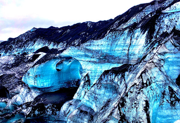
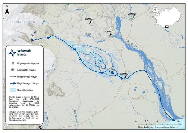
The volcano is covered by a 600 square meter glacier that is receding about 50 meters per year. Beneath the ice is a majestic blue glacier cave that is consistently changing due to rivers and waterfalls inside the glacier cave. Glacier melt water forms waterfalls around every corner making the cave interior a dynamic extreme environment that is consistently changing. There are 6 seismic stations surrounding the volcano and a satellite directly above it for monitoring for the potential lava uplift. There was a small subglacial eruption on 7/27/2024 which created a massive flood that took out the road system in southern Iceland.
Both Institute of Earth Sciences of Háskóli Íslands Jarðvísindastofnun Háskólans University of Iceland, School of Earth and Environment - University of Leeds have done an outstanding job with researching the compounding consequences of climate change and the associated impacts on the Katla volcano, the Mýrdalsjökull glacier and the Kötlujökull glacier.


Litli-Hurtur Volcanic Eruption & Moss Fires - Iceland
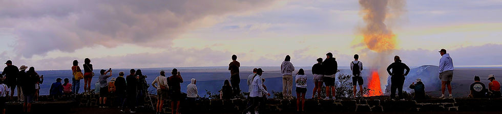
Between July 10th and August 5th, the Litli-Hrútur eruption site in Iceland’s Fagradalsfjall volcanic region attracted international scientists and captivated observers worldwide. On July 16, multiple university teams, in collaboration with professional remote pilots, conducted coordinated operations to support an air quality assessment focusing on inhalable particulate matter PM, sulfur dioxide SO₂, and other trace gases associated with basaltic lava emissions.
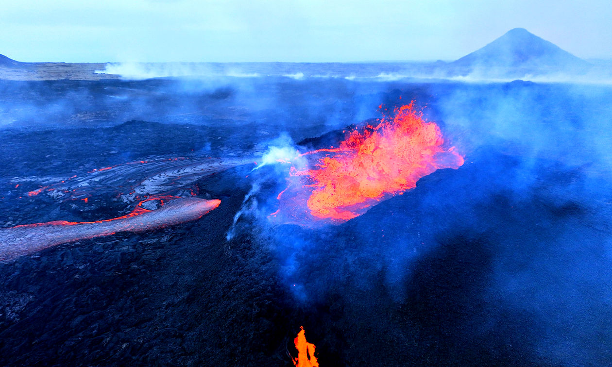
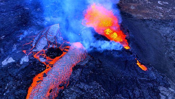
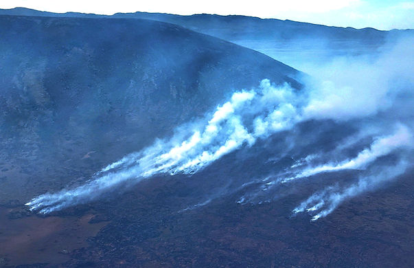
The 2023 Litli-Hrútur eruption occurred on the Reykjanes Peninsula in southwestern Iceland and marked the third consecutive year of volcanic activity in the region. The Fagradalsfjall system previously erupted in March 2021, releasing approximately 150 million cubic meters of magma, followed by another eruption on August 3, 2022, which lasted 21 days. Unusually dry summer conditions contributed to the ignition of moss fires, creating additional hazards for visitors to the area. Initial ground-based surveys were conducted at key observation points to measure concentrations of inhalable particulate matter PM₁.₀, PM₂.₅, and PM₁₀ as part of a public safety and hazard mitigation assessment. While this effort served as a collaborative scientific initiative, only a portion of the findings was used to inform Icelandic authorities.
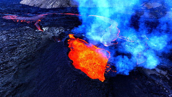
During the 2023 eruption, four professional teams from universities and private companies coordinated a series of advanced drone operations to complement the Icelandic Meteorological Office’s aerial survey efforts. These missions supported public safety assessments and hazard mitigation strategies. On July 16, 2023, the Icelandic Transport Authority (Samgöngustofa) temporarily restricted airspace around the volcano, granting drone teams permission to operate above the standard altitude limit of 120 meters.
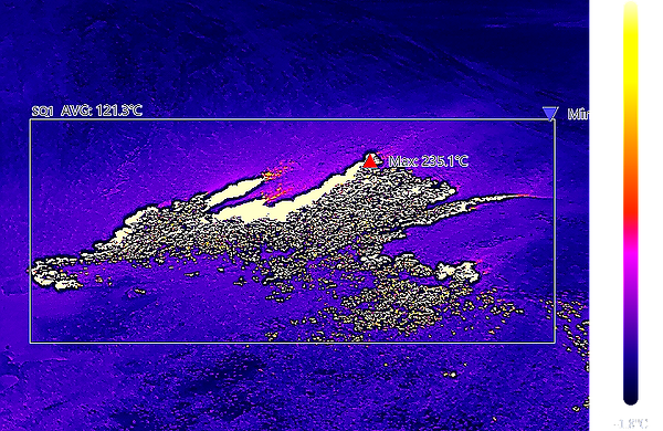
Drones equipped with thermal sensors were deployed to estimate the thickness and flow velocity of lava emitted from the main vent. Infrared IR sensors were also used to detect active lava tubes that may not be visible to visitors or through conventional RGB imaging, yet pose significant risks to individuals traversing the lava field. The use of drones proved to be an effective method for deploying specialized remote sensing equipment into hazardous areas, enabling the collection of valuable data and advancing scientific understanding of dynamic volcanic systems.


The emerging drone sector will continue to support the sciences by expanding remote sensing tools and techniques. It is creating new ways to model topography, both digitally and through 3D printing. Drones also enable scientists to take measurements in places that would otherwise be impossible to reach, including collecting samples from volcanic crater lakes and degassing volcanic plumes. As the industry grows, it is expected to keep contributing to chemistry, physics, engineering, computer science, and aeronautics. We sincerely hope this case study not only inspires readers but also offers practical strategies for gathering valuable information that can improve hazard mitigation and public safety in unique and volatile environments of special importance. We also hope the data presented in the publications proves useful to institutions looking to build on earlier methods, encourage innovation, and advance drone applications in educational research, atmospheric pollution data collection and analysis, along with public health awareness as well.
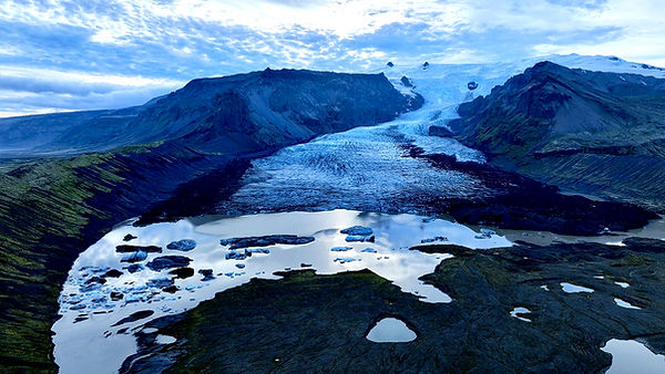


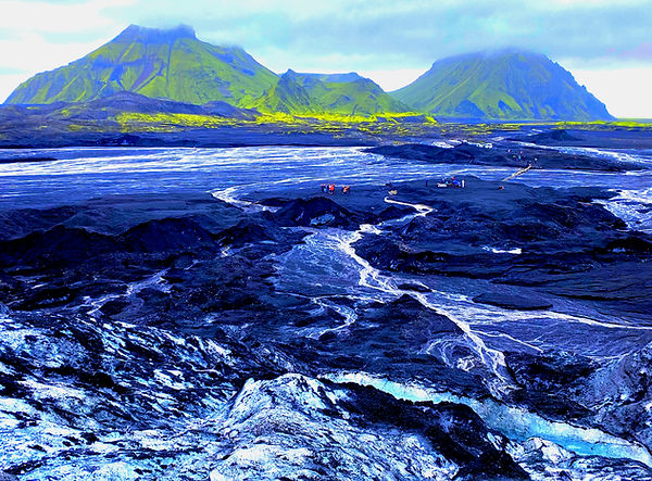
The image is from Vatnajokull National Park and is illustrating the receding glacier which has been severely impacted by global warming and climate change. The aerial perspective shows how the Earth is at risk and showcases how our consumption patterns and lifestyles are having global impact on some of the planets most fragile environments! During a fieldwork investigation associated with visualizing and digitalizing the glacier retreat at the Vatnajokull National Park in Iceland during July of 2024, we investigated how UAS technology can support the rapid digitalization of fragile and unique ecosystems subject to rapidly degrading effects from global warming and climate change.